



New Walking Signs Installed Between Town And Upper Rock
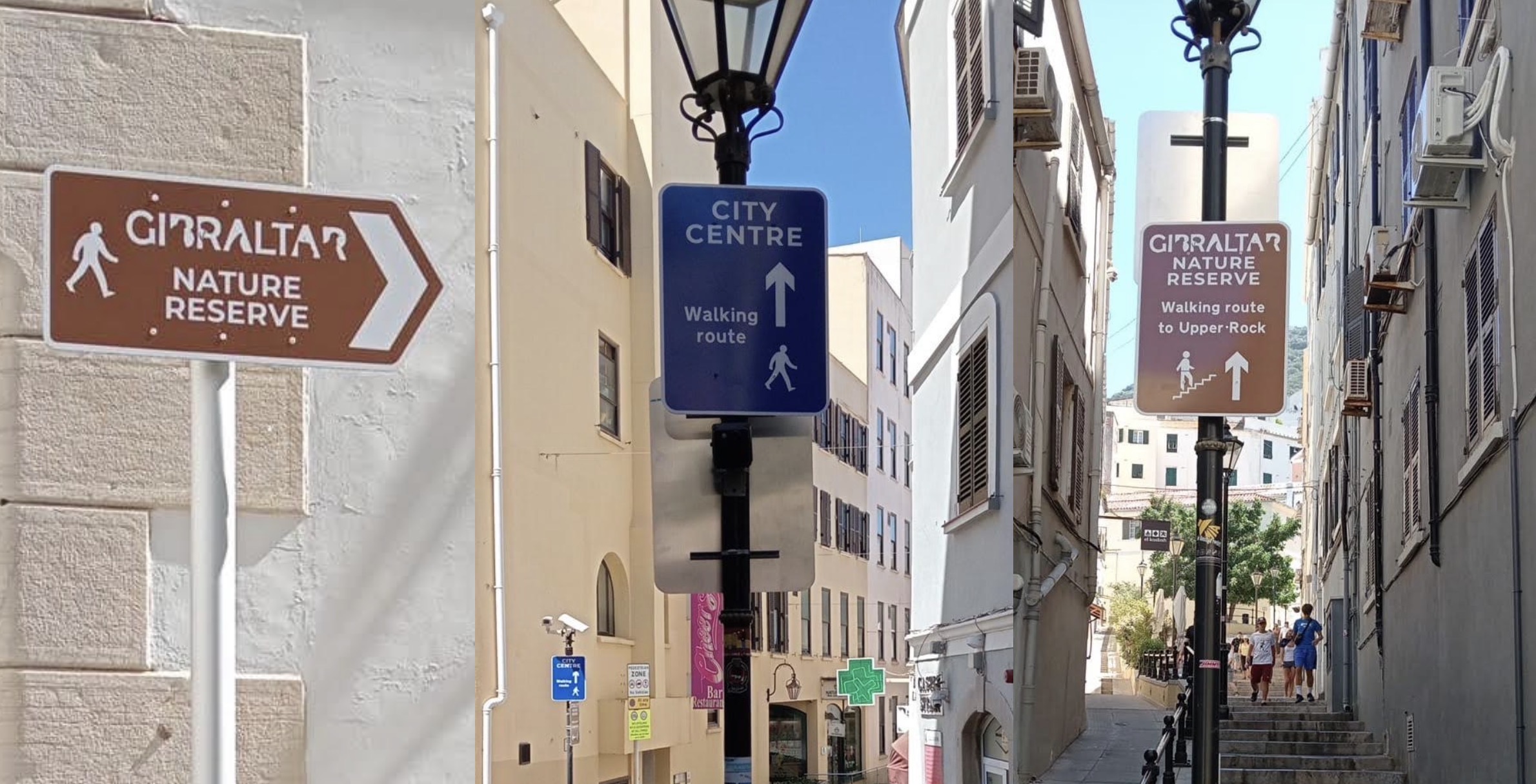
The Government has completed a new pedestrian wayfinding scheme to make it easier for people walking between Gibraltar’s City Centre, the Upper Town and the Upper Rock Nature Reserve.
A statement from the Government follows below:
The Ministry of Transport is pleased to announce the completion of a new pedestrian wayfinding signage scheme designed to improve walking routes between Gibraltar's City Centre and the Upper Town, providing clearer guidance for pedestrians travelling to and from the Upper Rock Nature Reserve.
The project addresses a longstanding issue whereby visitors and residents wishing to walk to the Nature Reserve had limited directional guidance once leaving the City Centre. Despite the route being one of Gibraltar's most popular walking corridors, the absence of consistent wayfinding signage often resulted in uncertainty, particularly for visitors unfamiliar with the Upper Town street network.
The new signage provides a clearly defined walking route from both Grand Casemates Square and John Mackintosh Square (the Piazza), guiding pedestrians via Bell Lane, Castle Street, Castle Steps, and onto Willis's Road, before continuing towards the Moorish Castle and the Nature Reserve.
To ensure the route is equally intuitive in both directions, corresponding directional signs have also been installed for pedestrians descending from the Upper Town, guiding them back towards the City Centre using the same route.
The scheme has been designed using recognised pedestrian wayfinding principles, providing clear, consistent and easy to follow directional information at key decision points along the route. The improvements are intended to encourage more people to explore Gibraltar on foot, making navigation simpler for residents and visitors while enhancing the overall walking experience.
The project forms part of the Government's continued commitment to promoting active travel and improving pedestrian infrastructure throughout Gibraltar. It supports the objectives of both the Active Travel Strategy and the Sustainable Traffic, Transport and Parking Plan (STTPP), which identify improved pedestrian connectivity and high-quality wayfinding as important measures in encouraging walking as a convenient, healthy and sustainable mode of travel.
By making routes to key attractions easier to navigate, the scheme also supports Gibraltar's tourism offering while encouraging greater use of walking routes that connect the City Centre with the Upper Town and the Nature Reserve.
Minister for Transport, the Hon. John Cortes said: "Walking is one of the simplest, healthiest and most sustainable ways of travelling around Gibraltar, and we want to make it as easy and enjoyable as possible for both residents and visitors. These new wayfinding signs provide a clear and continuous route between the City Centre and the Nature Reserve, removing uncertainty and making one of Gibraltar's most popular walking journeys much easier to follow."
"This project is another example of how relatively simple improvements can make a significant difference to people's experience of our streets. Together with the measures already being delivered through the Active Travel Strategy and the Sustainable Traffic, Transport and Parking Plan, these signs will encourage more people to explore Gibraltar on foot, support local businesses along the route, and reduce unnecessary reliance on vehicles for short journeys."